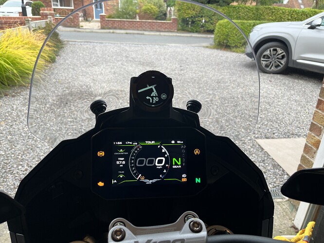
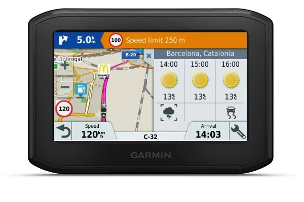
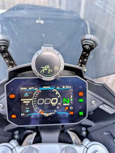
Having changed from a BMW GS to the V100S Mandello back in the spring, I was missing the Garmin sat nav being mounted above the TFT and in my line of sight (rather than down near the handlebars), so I don’t have to take my eyes off the road to see the screen.
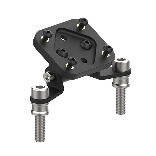
I bought an after market mount specifically for the V100 from Moto Mate (Raised Navigation Mount for Moto Guzzi V100 Mandello - Moto Mate). I was at first very disappointed, but in the longer run its turned into a blessing in disguise. - this is just my experience, not a recommendation!..…
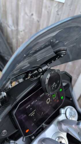
I had the mount fitted by the Guzzi main dealers when they removed the fairings to do some warranty work on a small coolant leak (from the seemingly inadequate hose clamps Guzzi have used in at least three places on the coolant system of the Mandello, all of which leaked under normal usage on my bike). The mount itself bolts in behind the TFT, which is then re-fitted to hold it in place. The mount fits well and is unobtrusive, but beyond that the problems started.
First, whilst Moto Mate correctly state that it will hold a Garmin or Tom Tom (or a phone), the mount itself doesn’t come pre-cut to allow the Garmin power cable to be fitted to the back of the Sat Nav. Rather than just run the Garmin off battery (3 hours max), the main dealers cut out a slot for the cable and wired the Garmin in.
Then the second problem became apparent. The Garmin Zumo XT weighs c280g and the mount is not that rigid. When riding normally, the Sat Nav was shaking so violently that the cable was repeatedly disconnecting and reconnecting, leading to the screen constantly going blank and then firing up again. On rough roads that could happen every two minutes. Clearly not an acceptable solution.
This led me to try trying the new, much smaller and lighter Beeline Moto 2 sat nav and for me it’s an utter game changer in a good way. At perhaps a third of the price of a recent Garmin, it’s much easier to use, gives me all the info I want and none of the clutter I don’t want. It lets me plot a route on an App so easily - trips to Scotland using great roads with a few cafe stops plotted in probably takes me under two minutes and I can text the GPX file to a friend in about a minute. The route immediately appears on my Beeline screen with turn by turn directions in my helmet intercom (subscription required on the app for spoken directions currently, but its optional as the sat nav flashes to tell you a turn is coming up). Route planning and re-routing do require phone signal, but riding the route doesn’t need signal and doesn’t drain much phone battery and the phone sits there in my pocket rather than exposed to the elements. The device itself now sits on the Moto Mate mount in my line of sight, giving me exactly what I want without all the faff of bigger sat nav models and it only weighs 47g so doesn’t vibrate at all on the mount. It just works brilliantly for me! I’d never go back to a Garmin or Tom Tom again having tried this.
The Beeline route planning uses Google Maps so finds places quickly and operates three ways: Fast route, fun route or compass only (which shows you the direction and distance as the crow flies to your destination and lets you pick the route as you ride). The battery lasts 10-14 hours depending on screen brightness and the battery and other components can be replaced or repaired rather than just buying a new device. It can be wired in to the bike battery, but easily runs off the USB option fitted to the dashboard on the Mandello if you need more than 14 hours, so why bother? It’s tiny and easily fits in a small pocket, yet the screen is perfectly adequate for me. It even shows things like farm entrances (which Garmin doesn’t) if I’m considering an overtake where there may be hidden entrances.
Downsides for me are few so far, but for balance:
- if you don’t enter a destination, it doesn’t show you a map of the road you’re riding like a Garmin would.
- It’s a colour TFT, but the map only shows you the road layout for the route ahead, plus any entrances to roads you need to ignore, it isn’t a full technicolour map, but I prefer that in many ways as it omits extraneous detail and I find it quicker to get the info I need from a glimpse.
- the algorithm that does fun routes doesn’t always get it right, it’s a work in progress, but it’s pretty good and sometimes stunning.
- you need phone signal to find nearby petrol stations if you didn’t plan them in at the start.
It won’t be everyone’s cup of tea. Creating and sharing routes is faster, but for ‘power users’ of Garmins it won’t suffice as simplicity is key for the Beeline Moto 2, and it simply doesn’t have the full functionality of a big sat nav costing 2-4 times as much and six times the size.
It does for me…perfectly, so thought I’d share my experience in case it helps. I really don’t want to get into a debate about why Garmin/Tom Tom are better - I have both a Tom Tom Rider and a Garmin Zumo (both of which I will now sell) and can absolutely understand why some people will far prefer them. That’s fine, we all have different needs and priorities. All I’m saying is that there Beeline has nailed it FOR ME, when it started as a compromise needed because the mount couldn’t cope with the weight of the Garmin wired in. I hope these insights are of interest/help.
